Tour of America - Volume II
- Blu Acciaio Editor

- Feb 8, 2018
- 7 min read
Updated: Apr 11, 2024
Even though only three years ago, back in 2015, it seems like an eternity since we rode from Seattle to San Diego and completed the first volume of our Tour of America. Seeing all the airplanes from Alaskan Airways taxing around at SeaTac when we flew home was all we needed to decide that Volume II be Anchorage, Alaska to Seattle, Washington. This year we made it so!
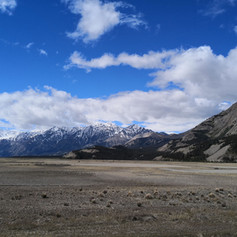
As usually we spent our fair share of time preparing for the tour. With vast distances to cover, limited service offerings and a rich wildlife, it became clear to us that this would be our most challenging feat yet. Approaching Anchorage from heaven above, that impression seemed to be correct, with endless snow covered mountains.

After stocking up at REI with gas, water filtering system, bear spray and what not, we were lucky to be invited to friends in Anchorage for a snack and some words of advice for the ride to come. Feeling mighty confident we set out early morning the day after. First stop, a campground outside Palmer in Alaska. That did not work out too well, as someone stole our food and backpack during the night. To date it is unknown if the perpetrators be beast or man. Regardless of that, no one were harmed and more importantly, the bike and most of the equipment were untouched. After a short detour to restock, we were back on the road, a bit more street smart on how to hide food and valuables.

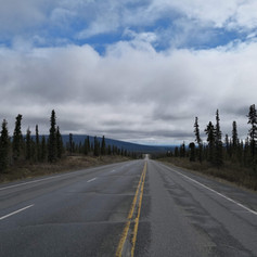
As we learned later, the more hardcore riders start in Prudhoe Bay and dont stop until they run out of road in Argentina. Although we are definitely improving, we are not up in the big league yet, and settled for a bit less ambitious route. We therefore headed directly East out of Anchorage, on Alaska Route 1 (AK1) to Tok. From there we followed the ALCAN Highway South and later got on the Cassiar Highway, before turning West over Whistler and going through Vancouver Island to get to Seattle.
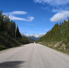
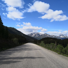
The landscape in Alaska is fascinating. It is so vast and varies between long flats and rolling hills as the road winds between the majestic mountains and endless forests. It is remarkable how considerate the drivers are, big rigs and cars alike, as they make ample space for riders. This was also the case in Canada. Big up to that!


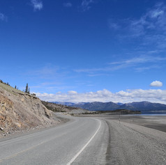
We crossed into Canada and Yukon Territory at Beaver Creek. Compared to the wilderness that lies further to both North and East, this part of Yukon hardly classifies as isolated, but it certainly is sparsely populated. Most places who has gotten the little dot at the map, indicating its a city, is usually comprised of one or two gas stations, who often doubles as grocery stores, some hardware stores and one or two motels. People are so friendly at these places and we often find ourselves in interesting conversations.


After some days of hard rain in Alaska, we got a taste of quite the opposite in Yukon Territory. Some of the days our computer showed a sizzling 41 degrees celsius. That is way above our comfort zone, particularly when riding for seven hours plus with limited possibilities for replenishing those fast draining water supplies. Our Platyplus bags really proved their worth on those stretches.

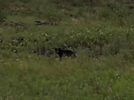
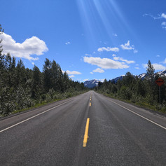
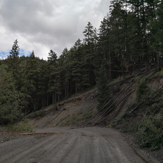
Upon reaching Nugget City and Junction 37, we turned South on the Cassiar Highway. This is a nearly 900 kilometers stretch that eventually leads on to Kitimat. The road is significantly narrower than the ALCAN Highway we were previously on. But the same goes for the traffic, which almost vanished. With less traffic comes more wildlife and it was along the Cassiar that we saw the most bears, just grassing there in the roadside. So unreal. Although these furry powder kegs can go from serenity to ultra violence in a matter of seconds, they seemed mighty peaceful to us as we pedaled by. We did however mind our distance. As tempting as it was to weasel ourselves closer to get that perfect bear picture, we honored our bear aware behavior, and settled for safe passage and a more blurry picture. Still seems like a good deal!


We did however also meet other, less intimidating, representatives of the wildlife in Canada. Some were quite willing to strike a pose, probably while they were working on an angle to get to our ever popular food cache. The most cunning one was this raggedy fox who had obviously found a niche charming travelers at one of the many break check spots along the highway.


Although quite long stretches with nothing but stunning nature, provincial parks are found at somewhat even distances along the Cassiar Highway. We particularly fancied the one at Boya Lake. The lake itself is beautiful, with glacier water and an inviting shoreline. The park also had a nice attendant that collected a modest fee and offered firewood.


There are also some small villages along the Cassiar. One of them is Dease Lake. We spent a day resting here and was so incredibly lucky to be invited to a mini-sightseeing by a local couple, in their seaplane no less. Definitely a highligt!


After putting the Cassiar behind us, we got onto Highway 16. This Highway is also called the Highway of Tears due to the large number of women being abducted along the road over the years. After the quiet and desolate Cassiar, it was a bit of an anticlimax to ride the Highway 16. The scenery is nice enough, but the area it runs through is much more populated and quite flat. Traffic also significantly picked up at this stretch. As such, it was with great delight we reached Clinton and could break away to Highway 97 and 99 to get to Horseshoe Bay and the ferry to Victoria. To make up for the last stretch of monotonous riding on Highway 16 we opted for a hilly shortcut between Clinton and Pavillion. The shortcut really paid off, with an epic climb, some places in excess of 16 % incline, and with a very rewarding descent at the end. As for climbs and descents, we also got our fair share of that from Lillooet to Pemberton.


From Horseshoe Bay we took the ferry from Nanaimo at Vancouver Island. The stages from there into Seatttle were more of transport stages, but with some nice ferry shuttling in between. It was in any case good with some stages that were a bit less demanding, after the more adventurous stages that lay behind us at that time.


As the saying goes, things are never as they appear, and that be certainly the case here also. When we set out we thought this would be far more dangerous and wild then what it turned out to be. Although quite a few isolated stretches, the service availability was much more frequent than expected. Traffic was not an issue, rather the opposite, it provided a safety net in case we or the bike broke down in the middle of nowhere. Bears on the other hand were way further between then what we had expected. At least the bears we saw. It may of course been bears watching us and not the other way around.
Another thing worth noting is how incredible helpful fellow tourers are. It seems to be a spirit of helping each other out and sharing whatever advice, food and parts one has to spare. We dig that! As one of the riders said: “I owe the road so much right now”. That definitely goes for us also, although we tried to even it out along the way.
So, thats it! We are back in our stronghold planning the third volume, the Trans Am!
See below for complete stage info, with GPX-files. Hit us if you have comments. We are probably out riding, but will get back to you as soon as possible.

Click the links below to download GPX-info for each stage

Comments